
+ (autumn)
The latest time-lapse video by Tokyo-based photographer Samuel Cockedey features captivating views of Mt. Fuji, Miyajima (Itsukushima Shrine), and Iwate prefecture.
+ (autumn)
The latest time-lapse video by Tokyo-based photographer Samuel Cockedey features captivating views of Mt. Fuji, Miyajima (Itsukushima Shrine), and Iwate prefecture.
Eleven winners of the "Japanese New Souvenir" competition -- a public contest to recognize novel souvenir concepts that creatively express elements of Japanese culture -- were exhibited last weekend as part of the Design Touch festivities at the Tokyo Midtown complex. Coming soon to a souvenir shop near you.
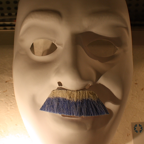
Moustache Fuji (Mariko Takeuchi)
"Moustache Fuji," a fake moustache resembling a snow-capped Mt. Fuji, is a subtle but bold fashion statement that pays homage to Japan's most sacred landmark. Described as a "moustache communication tool," this fun-to-wear facial accessory lets you inject a little Japanese flair into meetings, parties and summits.
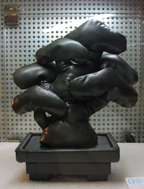
Air-Bonsai (Wabisabi)
"Air-Bonsai," a vinyl toy shaped like a potted dwarf pine, gives the traditional Japanese art of bonsai a pop-culture makeover. The soft vinyl tree packs flat into your suitcase for easy transport home.
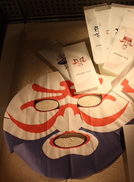
Japanese, Face (Kozue Kojima)
These "Japanese, Face" beauty masks moisturize the skin while giving you a traditional Japanese kabuki-esque appearance.
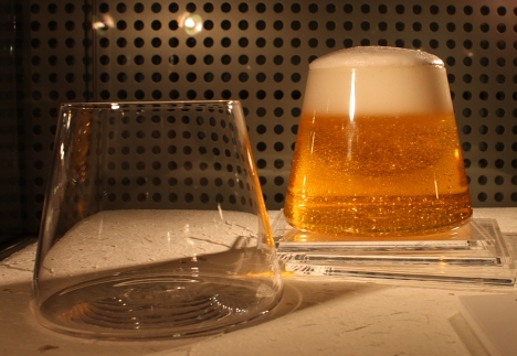
139 Views of Mt. Fuji (Keita Suzuki)
Inspired by Hokusai's famous "36 Views of Mount Fuji" series of woodblock prints, the "139 Views of Mt. Fuji" drinking glass lets you reflect on the ephemeral beauty of Mt. Fuji and the Japanese seasons while you drink. Enjoy a different "view" of the mountain with each new type of beverage you pour.
Other top souvenir concepts (not pictured) include "Kutsu-kutsushita" socks colored to look like shoes, incense sticks tied into traditional mizuhiki knots, and a round red "Hinomaru" paperweight that instantly transforms a stack of paper into the Japanese flag.
In addition to cash prizes, the winning designers will receive active support to help turn their concepts into marketable products. The contest was organized by Tokyo Midtown Design Hub, a consortium of industrial designers, graphic designers and educators focused on promoting Japanese design.
In Rin Nadeshico's computer graphic illustrations, Mt. Fuji looms in the distance as high school girls lounge around with various oversized creatures.
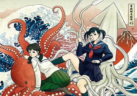
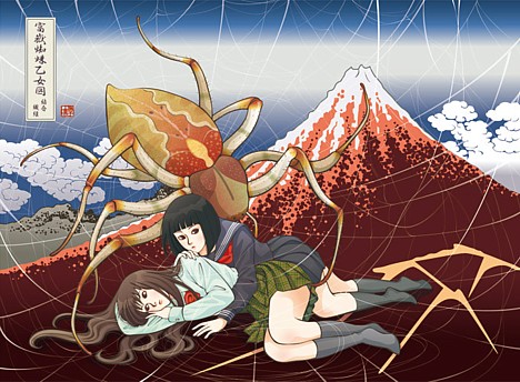
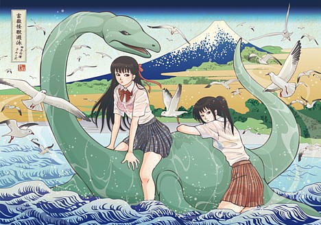
Lots more at Rin Nadeshico's website.
 Fuji Sabo Works, an organization established by Japan's Ministry of Land, Infrastructure and Transport (MLIT) to fight erosion on Mt. Fuji, has released video of a powerful slush avalanche that occurred on Fuji's western side at 8:09 AM on March 25.
Slush avalanches happen when cold, dry snow suddenly becomes saturated with water. About 90 millimeters (3.5 inches) of rain had fallen before the avalanche occurred.
The avalanche took place in an area on Mt. Fuji called the Osawa Collapse (Osawa Kuzure), a 2.1-kilometer (1.3-mile) long gully that begins near the summit and runs down the western side. The gully is up to 500 meters (1,640 feet) wide and 150 meters (490 feet) deep in some places, and according to this Fuji Sabo Works project outline (PDF), a total of 75 million cubic meters (2.6 billion cubic feet) -- equivalent to 60 Tokyo Domes -- of soil has been displaced. An estimated 150,000 cubic meters (5.3 million cubic feet) of soil washes out through the Osawa Collapse each year.
Check out video of the avalanche on Youtube (with smashing soundtrack by Caspar Brotzmann) or on the Fuji Sabo Works website (no audio).
[Via Slashdot Japan]

On February 15, the Japan Aerospace Exploration Agency (JAXA) exhibited the first photographic images captured by the Daichi advanced land observing satellite launched in January. Daichi is equipped with the three types of sensors, including the world?s first Panchromatic Remote-sensing Instrument of Stereo Mapping (PRISM), which simultaneously captures images from three directions to create 3D images of the Earth's surface.
The PRISM images, taken on the morning of the February 14, show the area around Mt. Fuji and Shimizu Port in Shizuoka Prefecture. Objects as small as 2.5 meters (8.2 feet) across are visible.
Daichi?s 3D images of the area around Mt. Fuji show Kofu City?s urban sprawl, the Fuji Five Lakes (Fujigoko), and the detailed terrain of the snow-capped peak of Mt. Fuji. Small buildings and roads are visible in the images, which were taken from an altitude of 700 kilometers (435 miles).
Daichi uses PRISM to create maps on the scale of 1:25,000. The satellite is expected to play a key role in disaster relief by quickly gathering image data of areas hit by large-scale disasters.
[Source: Mainichi Shimbun via Yahoo! News Japan]
UPDATE: Check out the 3D video compiled from the images (MPEG: 3.6M)